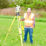
We combine decades of field experience with modern technology—like aerial drones and advanced GPS systems—to provide accurate, actionable data that keeps your project moving forward. From complex commercial construction projects to residential lot surveys, we do it right the first time.
We proudly serve Stark County as our primary service area, while also offering extensive land surveying expertise throughout Columbiana County, Summit County, Carroll County, Tuscarawas County, and Portage County. Our firm holds the complete survey records of Ed Browne and Associates—a respected second-generation surveyor in Columbiana County—giving us a unique advantage in providing fast, accurate, and historically grounded surveys in that region. Whether you’re in Canton, Alliance, Lisbon, or surrounding communities, DSI Ohio delivers precise and efficient land surveying solutions backed by decades of experience.
We provide American Land Title Association/National Society of Professional Surveyors surveys, ensuring comprehensive and accurate property data.
We offer detailed construction surveys, including layout and staking services, to support various phases of construction projects.
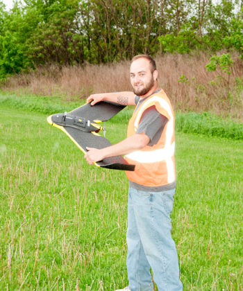
Our UAV-based aerial mapping services deliver high-resolution, geo-referenced images and 3D models, facilitating efficient planning and analysis.

Whether you’re developing land, planning construction, or need precise data for real estate or environmental work, Deibel Surveying Inc. is here to help.
Education:
Currently pursuing Bachelor of Surveying and Mapping, University of Akron
Professional Experience:
Professional Experience

Education
Professional Experience:

Education: Bachelor of Science Degree, Mathematics, Kent State University (June 1975)
Professional Experience: