Deibel can traverse the waterway using a sonar unit to produce depths and Real Time Kinematic (RTK) GPS receivers to establish X, Y and Z locations at a minimum of 10 foot spacing.
Bathymetric Surveying Service
Serving Stark County, Canton, Massillon, Akron, Cleveland, Dover, New Philadelphia and Northeast Ohio.
The sonar data is meshed with the GPS data and output to a PC with a readable screen. The larger screen is mounted in view of the boat operator in order to collect data in the preordained transversal lines and to ensure full coverage and avoid overlapping points. This method is very similar to what is noted as “side scan.”
A minimum of six satellites is needed to get accurate locations. The GPS and GLONASS, or Russian constellations, are used together to get a larger number of satellites to work in confined and obstructed areas. Where the overhead is too obstructed for GPS data, Direct Read Survey Instrument or traditional Instrument & Prism will be used to gather the data.
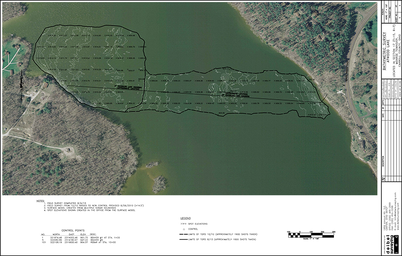
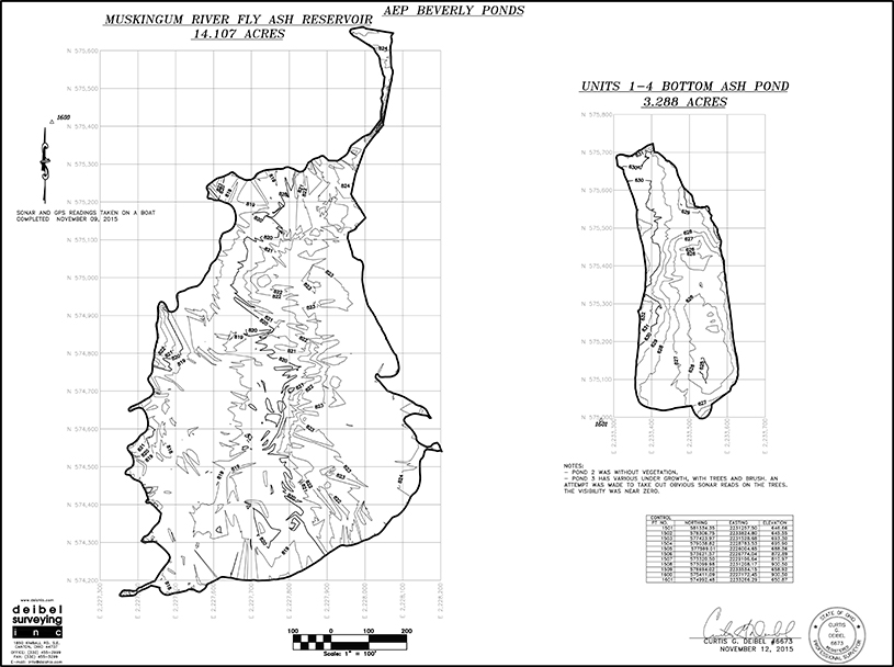
The data is given to a CAD Operator to inspect the field data for errors or omissions. A topographic map will be provided with one foot or two foot contours. The contour map is not used for calculations, but this is where any problems can be identified. The finished contour map is inspected by the field crew before it is completed and a .PDF and CAD file will be provided.
Accuracy Within 0.1’ – 0.3’ depending on heavy vegetation
Bathymetric Equipment
Topcon Hyper GPS System
Trimble S-6 Total Station; fully robotic
12’ Smoker Craft Aluminum boat equipped with an on-board computer
We serves private clients, public agencies, and municipalities.
Let’s Discuss Your Project Needs Today
Partner with a trusted surveying team that delivers accuracy, reliability, and results—on time and on budget.
Whether you’re developing land, planning construction, or need precise data for real estate or environmental work, Deibel Surveying Inc. is here to help.